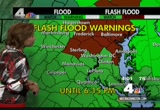
the satellite data used 24/7, is used in a forecast model, hurricane models, every day models, the forects they put out every day. >> those models that he's talking about, that's the guidance we look at to put together the forecast. the beer the satellite data gets, the better our forecast will get. we're not just talking about tracking hurricanes but other thing as well. the next generation will be out very soon. satellites in ace, by the way, the size of a school bus. it takes about six years to build one of those. take a look at these satellite imges. they're looped together. this system hear, that is karl. it made landfall over the southern yucatan. it is moving to the west and will reemerge. that's igor, añlcategory 4. it will moving dangerously close to bermuda, coming up at the end of the week. we're going to get some rough seas from it. friday, saturday, sunday. then we've got julibehind it. i have to tell u, the atlantic has not seen two category 4 hurricanes simultaneously since going all the way back to 1926. he's more on that track of igor here. ou can see how close it gets ju
 Live Music Archive
 Librivox Free Audio
 Metropolitan Museum
 Cleveland Museum of Art
 Internet Arcade
 Console Living Room
 Books to Borrow
 Open Library
 TV News
 Understanding 9/11